
HIKING TRAIL GUIDE FOR DEVIL’S LAKE STATE PARK
Choose the Right Trail for Your AdventureBest Scenery in the midwest?
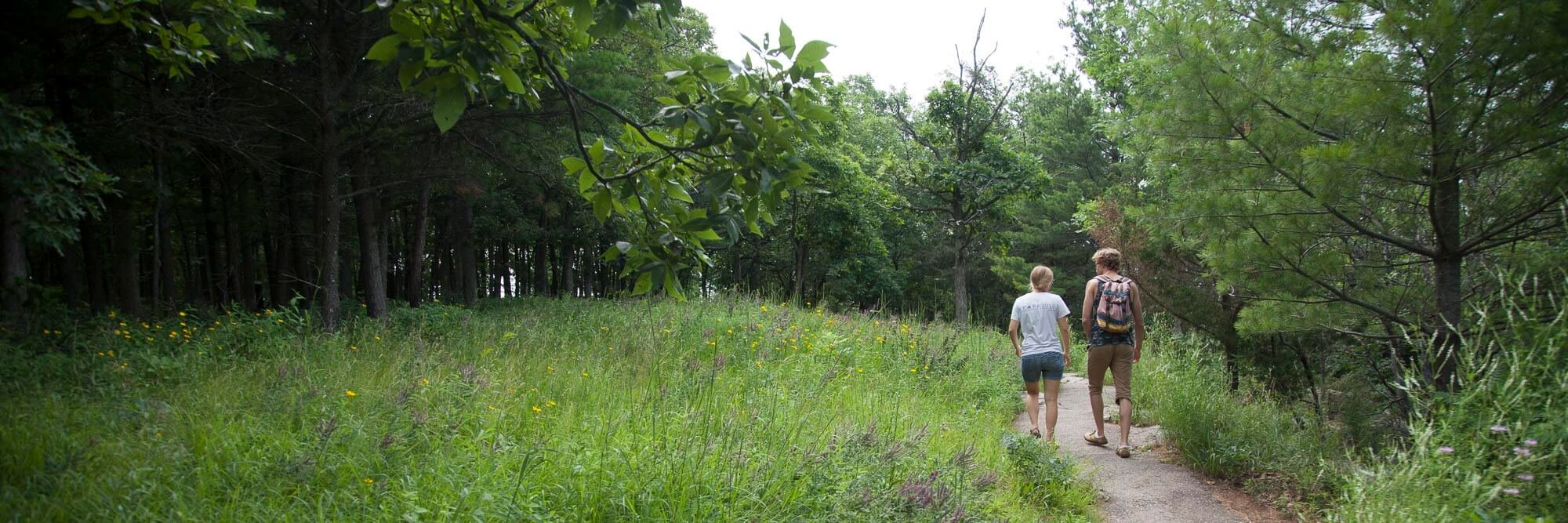
Hiking at Devil's Lake State Park centers around the Lake itself. Options include easy, paved paths amongst the lakeshore talus slopes, rolling saunters amongst oak woodlands, and heart-thumping climbs along the 500-foot-high quartzite cliffs.
On weekends and summer months, these trails are popular and well-traveled, but you can always find quiet serenity in the early morning hours, on less-used trails and during off-season months.
Find Quieter Trails & Thinner Crowds
If you have already explored the main trails around Devil's Lake, it's worth hiking the longer trails east of main visitation area. Trails like Roznos Meadow and the Sauk Point Trail explore grasslands, wetlands, and riparian areas off the beaten path and provide longer distances for eager hikers.
Ice Age National Scenic Trail
You may see signs for the Ice Age National Scenic Trail around Devil’s Lake. The IANST is one of our country’s eleven National Scenic Trails, a 1,000-mile foot path stretching from Door County to the northwestern Wisconsin-Minnesota border. The Devils Lake section is maintained by a partnership between the Park and the volunteer-run Baraboo Hills / Heritage Chapter of the Ice Age Trail Alliance. Helping build the Ice Age Trail is a fun, social, and physcial way to contribute to Devils Lake and the larger Ice Age Trail effort; see the Chapter's event calendar for opportunities to get involved.

Devil's Lake State Park Trail Map
(click for expanded, downloadable map)
Devil’s Lake Hiking Trail summary Chart
Distances, difficulty, estimated time and short descriptions for Devil's Lake hikes near Baraboo, Wisconsin. Click on an individual trail name for a full description and photos.
| Hiking Trail Name | Distance (mi) | Estimated Duration | Relative Difficulty | Brief Description | Highlights |
|---|---|---|---|---|---|
| Balanced Rock Trail | 0.4 | 15 - 45 minutes | Most Strenuous | Steep ascent/descent with overlooks of the lake and South Shore Picnic area. | Find Balanced Rock, a boulder perched on a tall cliff, much larger on top than it is on bottom. |
| CCC Trail | 0.3 | 15 - 45 minutes | Strenuous | Switchback route ascending through woods and talus to top of the East Rampart. | See rock climbers attempting steep, tall faces near the top. |
| Devil's Doorway Trail | 0.1 | 10 minutes | Moderate | Short off-shoot of the East Bluff trail visiting Devil's Lake most iconic landmark. | Huge, doorway feature stands atop the cliff edge, framing Devil's Lake beyond. |
| East Bluff Trail | 1.7 | 45 - 90 minutes | Strenuous | Follows top of East Bluff connecting CCC, Potholes and Balanced Rock Trails with North Shore. | Numerous cliff-top vistas overlooking Devil's Lake, Lake Wisconsin, Baraboo and more. |
| East Bluff Woods Loop | 3.4 | 2 - 3 hours | Moderate | Easier double-track access road parallels East Bluff trail deep in the woods. | Glacial erratics and a nice creek. |
| Grottos Trail | 0.7 | 20 - 30 minutes | Easy | Traverses valley in South Shore area, connecting Balanced Rock, Potholes & CCC trails. | Gorgeous mature oak forest with views of the East Bluff talus fields and large, cool rock hollows. |
| Group Camp Trail | 0.5 | 15 - 20 minutes | Easy | Connects South Shore area with Group Camp loop. | |
| Johnson Moraine Loop | 2.8 | 60 - 90 minutes | Moderate | Rolling trail exploring marshes and hummocks of kettle-moraine landscape. | Excellent birding in marsh areas. |
| Parfrey's Glen Trail | 0.7 | 15 - 30 minutes | Easy | Follows creek into a deep, lush gorge through deciduous woodlands. | Deep, cool and mysterious gorge with enormous boulders and mandatory creek walking. |
| Potholes Trail | 0.3 | 20 - 30 minutes | Most Strenuous | Steepest path up East Bluff up hundreds of rock-hewn steps laid by CCC workers. | Short but beautiful Red Cliffs, where a big pine grows between 30' red cliff walls. |
| Roznos Meadow Trail | 1.8 | 45 - 90 minutes | Easy | Traverses rolling restored prairie at foot of ancient glacial moraine. | Copious spring wildflowers, easy strolling and views of East and South Bluffs. |
| Sauk Point Trail | 4.5 | 2 - 4 hours | Moderate | Rolling woodland trail connecting East Bluff area with Parfrey's Glen. | Narrow, winding trail visits bogs, dense forest, highest point in Sauk County with views to Blue Mounds. |
| Steinke Basin Loop | 2.4 | 1 - 2 hours | Moderate | Rolling double-track trail in quieter areas of the Park. | Serene quiet with visits to creeks and access to cliff views via connecting trails. |
| Tumbled Rocks Trail | 1 | 20 - 45 minutes | Easy | Paved , mild trail follows foot of West Bluff through talus fields along the Lake. | Views of lake and East Bluff. Great access for boulder scrambling, fishing and swimming. |
| Uplands Loop | 3.8 | 75 - 120 minutes | Moderate | Double-track loop connecting Steinke Basin, Johnson Moraine and East Bluff trails. | Great options for connecting with other trails for a long hike, run, or mtn bike ride. |
| West Bluff Trail | 1.4 | 60 - 90 minutes | Strenuous | Follows top of West Bluff, connecting North and South Shore areas. | Spectacular views of Lake, North and South Shores, East Bluff from many rocky buttresses. |
| Ice Age Loop | 13.7 | 8 - 10 hours | Strenuous | Loop connecting West Bluff, East Bluff, Steinke and Sauk Point trails. | Best opportunity to see all the Park has to offer in a long, continuous hike or run. |