

DIRECTIONS
Getting to Devil's Lake State Park in Baraboo, WIWhere in Wisconsin is Devils Lake State Park?
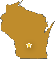
Location of Devils Lake State Park, WI
Devils Lake State Park is just south of Baraboo, Wisconsin and Interstate 90-94. The best directions to Devil's Lake State Park for your party depends on:
Where you are coming from
Which entrance you'd like to reach
It's common to get lost/disoriented while finding your way into the Park, so figure out which entrance you're shooting for and follow the directions below. Plan ahead and purchase a Wisconsin annual parks pass before your trip to save you time and money.
South Entrance
(Most Climbing, Group Camp, Hiking Trailheads, Beach)
Those going rock climbing will probably want the South Entrance, not the North Entrance. If you are trying to reach the South Shore area and using GPS, you cannot get accurate directions by simply typing in "Devil's Lake State Park" because the only official address at the Park is the North Visitor Center area. Instead, you must enter specific coordinates for the various climbing/hiking trailheads:
BOAT RAMP TRAILHEAD: 43.412310, -89.739358
SOUTH SHORE PICNIC AREA: 43.411262, -89.724257
CCC TRAILHEAD: 43.410828, -89.710699
OLD SANDSTONE AREA: 43.411842, -89.687497
You can also print out the Devils Lake State Park map and bring it with you for easier navigation.
North Entrance
(Bouldering trips, Most Camping, Visitor Center, Hiking Trailheads, Beach)
If you're meeting us for a bouldering trip, we may have asked you to meet us at the North Shore Parking Lot:
NORTH SHORE PARKING LOT: 43.427864, -89.727099
Directions to North & South Shore Areas from Major Cities
FROM MADISON | MAP LINK
Get on the Beltline (US 12/18) and follow US-12 west out of Madison toward Sauk City. Continue over the Wisconsin River and past Sauk City. About 11 miles past Sauk City, you climb a steep hill; you are getting close. For the South Entrance, turn right on Ski-Hi Road, then turn right on South Shore Road to enter the Park. For the North Entrance, drive a few more miles and turn right on WI-159, then right on WI-123. Follow the big, obvious sign into the Park via Park Road.
FROM MILWAUKEE OR NORTH CHICAGO | MAP LINK
Take I-94 West to Madison, then head north on I-94 West/I-90 North. Take exit 108A and follow WI-78 South toward Merrimac. After 9.9 miles, turn right onto County Road DL. When DL meets WI-113, turn right. For the South Shore, turn left soon after on South Shore Road. For the North Entrance, follow WI-113 2.3 miles, then turn left onto County Road DL. After two more miles, turn left into the Park on Park Road.
FROM GREEN BAY | MAP LINK
Take US-41 South from Green Bay and follow it through Oskkosh. South of Oshkosh, take exit 113 for WI-26 and follow it to US-151 South. Take exit 147 near Waupun, merging onto Fond du Lac Street. Drive 1.6 miles to East Main Street, then turn left onto WI-68. Follow WI-68 9.5 miles to WI-33 in Fox Lake, then follow WI-33 46 miles, through Portage, to Baraboo. Turn left on Broadway, continuing on South Boulevard, and turn left on South Pkwy. Continue onto WI-123 about 1.5 miles. For the North Shore, follow the big, obvious sign into the Park entrance; for the South Shore, turn right on South Shore Road and follow it over and down the hill to the windy switchbacks of the South Entrance.
FROM THE TWIN CITIES (MINNEAPOLIS/ST.PAUL) | MAP LINK
This is really easy. Take I-94 East 210 miles, just past Lake Delton, WI. Take exit 92 onto US-12 East, and continue just over 7 miles. For the North Entrance, turn left on WI-159, then right on WI-123. Follow the big, obvious sign into the Park via Park Road. For the South Entrance, follow US-12 a few miles further to Ski-Hi Road (look for the apple orchard sign), then turn left. Over the hill, turn right on South Shore Road and enjoy the curvy entrance to Devils Lake State Park.
FROM ROCKFORD OR WESTERN CHICAGO | MAP LINK
Follow I-39 North/I-90 West to the outskirts of Madison, WI. Near Madison, turn left onto US-12 West. Stay on US-12 through Madison, Middleton, and Sauk City, driving approximately 45 miles to the Baraboo Hills. After you climb the steep, forested hill near Baraboo, turn right on Ski-Hi Road to reach the South Entrance, or right on 159 to reach the North Entrance.
FROM IOWA | MAP LINK
From Dubuque, follow State Route 151 north. Near Dodgeville, take exit 44 to merge onto State Route 23. Follow WI-23 north just over 20 miles, across the Wisconsin River and through Spring Green to WI-14. Turn left onto WI-14, following it west for just 0.4 miles, then turn right on WI-60. Follow WI-60 for just under 20 miles, then head north on Highway 12 outside Sauk City. After you climb the steep, forested hill near Baraboo, turn right on Ski-Hi Road to reach the South Entrance, or right on 159 to reach the North Entrance.